Instead of following the southern traverse like all the other west approaching routes, the Northern Circuit traverses the mountain around the quiet, rarely visited northern slopes. While you trek, you will see nearly 360 degrees of beautiful scenery as you traverse the mountain at 13,000 feet. As the longest route on Kilimanjaro, the Northern Circuit also has the longest acclimatization time, giving you the highest chance of reaching the summit successfully.
Best time to visit: Dec-Mid-March / Mid-June-October
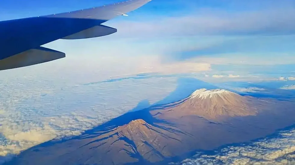
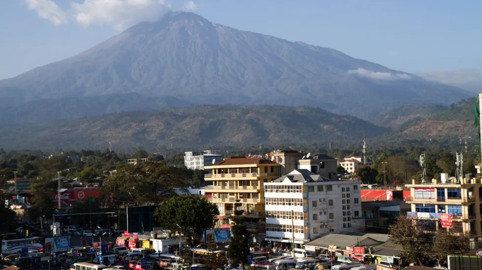
Discover The Unexpected Mount Kilimanjaro, located in Tanzania, is the highest freestanding mountain in the world and the tallest peak in Africa. Overview of Mt. Kilimanjaro Rising 5 895...
Day by Day Itinerary
Day 1 -Day 1 - Airport pick-up- Drop off at Hotel
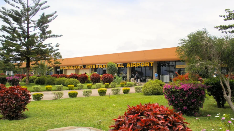
You will be picked up by the staff of Gosheni Safaris from Kilimanjaro International Airport (JRO) and driven to your accommodation in Arusha. Participants will be given a short briefing for the climb the next day. Kits and the necessary equipment will be checked as well.
Inclusion
Meals: Dinner
Accommodation
Sg Resort
Day 2 -Day 2 - Arusha- Londorossi Gate to Forest Camp
Elevation (ft): 7,800ft to 9,500ft
Distance: 6 km
Hiking Time: 3-4 hours
Habitat: Rain Forest
We depart Arusha for Londorossi Gate (2 hours), where you will complete entry formalities. We then drive to the Lemosho trailhead and arrive in time for lunch. Afterwards, we walk through undisturbed forest, which winds to the first campsite.
Inclusion
Meals: B,L,D
Accommodation
Camping
Day 3 -Day 3 - Forest Camp to Shira Camp 1
Elevation (ft): 9,500ft to 11,500ft
Distance: 8 km
Hiking Time 5-6 hours
Habitat: Moorland
We continue on the trail leading out of the forest and into a savannah of tall grasses, heather, and volcanic rock draped with lichen beards. As we ascend through the rolling hills and cross several streams, we reach the Shira Ridge before dropping gently down to Shira 1 camp. Here you will have an amazing view of Kibo from across the plateau.
Inclusion
Meals: B,L,D
Accommodation
Camping
Day 4 -Day 4 - Shira Camp 1 to Shira 2
Elevation (ft): 11,500ft to 13,800 ft •Distance: 14 km •Hiking Time: 5-7 hours• Habitat: Moorland
We explore Shira plateau for a full day, one of the highest plateaus on earth. It is a gentle walk towards Kibo’s glaciered peak, across the plateau, which leads to Shira 2 camp on moorland meadows by a stream. A variety of walks are available on Lent Hills making this an excellent acclimatization opportunity.
Inclusion
Meals: B,L,D
Accommodation
Camping
Day 5 -Day 5 - Shira Hut – Moir Hut
Elevation: 4,200m
Distance: 14 km
Hiking 5-7 hours
Today, we trek in high altitude and sleep in a low altitude, which is good for the acclimatization process. We spent the morning trekking up to Lava Tower and the iconic Shark’s Tooth rock formation at 4,600 meters where you will have lunch. After, we head down to the northern circuit to Moir Camp at 4,200 meters.
Inclusion
Meals: B,L,D
Accommodation
Camping
Day 6 -Day 6 - Moir Camp (4,200 meters) to Buffalo Camp (4,020 meters)
Elevation: 4,020m
Distance: 12 km
Hiking 5-7 hours
We leave Moir Valley and take a short walk to reach the summit of Little Lent hill at 4,375 meters with amazing views. After, we return to the trail and head eastwards throughout the northern circuit path to Buffalo Camp. Here, you will be welcomed with a vast space of Kenyan plains stretch out far below to the north.
Inclusion
Meals: B,L,D
Accommodation
Camping
Day 7 -Day 7 - Buffalo Camp (4,020 m) to Rongai Third Cave (3,800 m)
Elevation: 4,020m-3,800m
Distance: 8 km
Hiking 5-6 hours
Today, the trek will be shorter and you should be feeling well acclimatized to the altitude. We climb up the Buffalo ridge and down into Porfu Camp where lunch will be served. The route then continues east around the northern slopes to the Rongai Third Cave at 3,800 meters. You will arrive at the Third Cave just around mid-afternoon.
Inclusion
Meals: B,L,D
Accommodation
Camping
Day 8 -Day 8 - 3rd Cave (3,800 meters) to School Hut (4,800 meters)
Elevation: 4,800m
Distance: 15 km
Hiking 4-5 hours
After breakfast, we ascend to The Saddler, lunar panorama between the peaks of Kibo and Mawenzi. Afterwards, we proceed upwards and arrive at School Hut Campsite early in the afternoon. You can spend the rest of the day relaxing and preparing for the summit day.
Inclusion
Meals: B,L,D
Accommodation
Camping
Day 9 -Day 9 - School Hut (4,800 m) to Uhuru Peak (5,895 ms) and then onto Millennium Camp (3,950 m)
We’ll start our ascent by midnight and use a torchlight so that we can reach the Crater rim by daybreak. It will be a steep climb for about 5 or 6 hours over unfastened volcanic scree up to Gilmans stage (5,685 m). We shall rest there for a a while admiring the daybreak over Mawenzi. The trail leads west alongside the crater rim to Uhuru Peak (5,896 m), passing close to the spectacular glaciers and ice cliffs that additionally occupy quite a lot of the summit area. We then retrace our steps alongside the crater rim to Stella Stage. Afterwards, we descend down to Barafu Camp stopping at Barafu for lunch. Here you might need gaiters and trekking poles for the loose gravel going down. Mweka Camp is situated in the upper forest and mist or rain can be expected in the late afternoon. Later in the evening, we enjoy our last dinner on the mountain and a well-earned sleep.
Inclusion
Meals: B,L,D
Accommodation
Camping
Day 10 -Day 10 - Millennium Camp to Arusha
Elevation 3,950 to 1640m
Distance: 10 km
Hiking Time: 3-4 hours
Habitat: Rain Forest
After breakfast, we continue the descent down to the Mweka Park Gate to receive your summit certificates. At lower elevations, it can be wet and muddy so Gaiters and trekking poles will help. From the gate, we continue another hour to Mweka Village where our vehicle awaits to driveus back to the Hotel in Arusha.
Inclusion
Meals: B,L,D
Accommodation
Camping
Inclusions
Park fees
All activities (unless labeled as optional)
All accommodation as stated in the itinerary
A professional driver/guide
All transportation (unless labeled as optional)
All Taxes/VAT
Roundtrip airport transfer
All Meals (as specified in the day-by-day section)
Drinking water on all days
Camping Equipment
Porterage
Exclusions
International flights (from/to home)
Additional accommodation before and at the end of the tour
Tips (tipping guideline US$20.00 pp per day)
Personal items (souvenirs, travel insurance, visa fees, etc.)
Government imposed increase of taxes and/or park fees
Alcoholic drinks
Rescue Fee
Climbing Gear
Sleeping Bag
Frequently Asked Questions
These are general FAQ to guide your planning. For detailed information specific to your destination, please visit the corresponding page on our website.
What is the best time to climb Mount Kilimanjaro?
Most guided climbs have experienced guides and porters trained in first aid. In case of emergencies, evacuation procedures are in place, including the use of helicopters if necessary.
How long does it take to climb Mount Kilimanjaro?
The duration of the climb depends on the route chosen, but most treks take between five to nine days to reach the summit and descend.
What is the altitude sickness risk on Mount Kilimanjaro?
Altitude sickness can affect climbers due to the rapid altitude gain. It’s essential to acclimatize properly and be aware of symptoms such as headache, nausea, and dizziness.
Do I need prior climbing experience to climb Mount Kilimanjaro?
No prior climbing experience is necessary, but a reasonable level of fitness and preparation is recommended for the trek.
What should I pack for climbing Mount Kilimanjaro?
Essential items include sturdy hiking boots, warm clothing, a sleeping bag suitable for cold temperatures, waterproof gear, and high-energy snacks. Check out our packing list for a comprehensive reference.
Are permits required to climb Mount Kilimanjaro?
Yes, permits are required for all climbers, and they must be arranged in advance through a licensed tour operator.
What type of accommodation is available during the climb?
Accommodation on Kilimanjaro varies depending on the route but generally includes tents for camping and lodges along the trekking route.
Is it possible to climb Mount Kilimanjaro independently?
While it’s technically possible, climbing Kilimanjaro without a guide is strongly discouraged due to safety reasons and the complexity of the terrain.
What is the success rate for reaching the summit of Mount Kilimanjaro?
The overall success rate for reaching the summit of Kilimanjaro is around 65-70%, with factors such as route choice, fitness level, and altitude acclimatization affecting individual success.
Are there age restrictions for climbing Mount Kilimanjaro?
There are no strict age restrictions, but climbers must be in good health and sufficiently fit to undertake the trek.
What is the difficulty level of climbing Mount Kilimanjaro?
Climbing Kilimanjaro is considered challenging, primarily due to the altitude and unpredictable weather conditions. However, with proper preparation and guidance, it is achievable for many trekkers.
What happens in case of emergency during the climb?
Climbing Kilimanjaro is considered challenging, primarily due to the altitude and unpredictable weather conditions. However, with proper preparation and guidance, it is achievable for many trekkers.
How much should I tip the guides and porters on Mount Kilimanjaro?
While tipping is not mandatory, it is customary to show appreciation for the hard work of guides and porters. A suggested amount is around $20 USD per day, per person, but tipping amounts may vary based on the level of service and satisfaction.
Tour Inquiry
Your journey begins here – Explore bespoke tours tailored to your interests through our Tour Inquiry section.